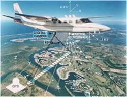
Aerial Survey
Aerial photography and geospatial mapping
We are leading in innovative aerial photography and geospatial mapping and offer a wide range of services including photogrammetry and remote sensing surveys.
Aerial survey is a method of collecting geomatics or other imagery by using aeroplanes, helicopters, UAVs, balloons or other aerial methods.
Our specialties
- Aerial Photo (photo mission planning and consultation).
- Control and cadastral surveys.
- Photogrammetric scanning and aerial triangulation.
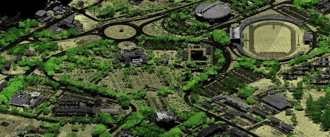
- Digital mapping and terrain modelling.
- Update, transfer and mapping from satellite imagery.
- Cross-sections and profiles / Volumetric calculations.
- Orthophoto creation and mosaicing.
- GIS data conversions & transformations.
- Cost effectiveness.
- 24*7 customer support.
Our Mission
The mission of the MCS GEOTECH is to coordinate, educate, guide and assist the implementation, maintenance and development of GIS (Geographic Information Systems) technology in the country.